Mt Ruapehu - photos
 |  |  |  |
 |  |  |  |
 |  |  |  |
 |  |  |  |
 |  |  |  |
Related Photo Galleries | |||
 |  |  |  |
About Mt Ruapehu
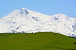
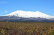
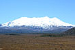
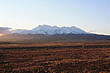
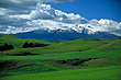
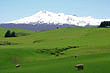
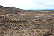
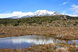
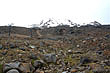
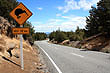
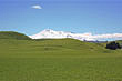
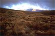
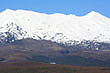
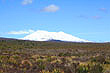
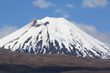
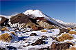
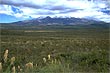
Mt Ruapehu is New Zealand's highest volcano reaching 2797m which also makes it the highest mountain in the North Island. It is also one of the world's most active volcanoes. It is an active stratovolcano with a single vent and crater lake. It lies at the southern end of the Taupo Volcanic Zone and last erupted in 1995 and 1996.
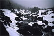
Since 1861, there have been ten eruptions and sixty lahars on Ruapehu. Lahars are more numerous and have also proved more dangerous and deadly than the eruptions. They are formed between eruptions when a lake forms in the crater from melting snow. The walls of the crater or caldera as it is known gives way due to the weight of the water which forces the caldera ridge outward. The result is a breach that causes a massive flow of water and earth as well as collected debris onroute as it flows down the mountain. In Ruaphehu's case lahars flow toward farmland and even small towns below. In 1953 a lahar killed more than 150 people when a railroad bridge was taken out resulting in a passenger train plunging into a deep ravine.
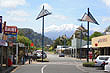
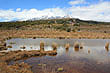
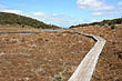
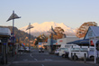
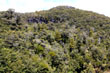
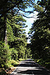
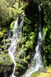
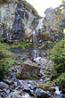
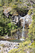
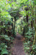
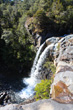
The North Island's only glaciers are on the slopes of Ruapehu. There are also three ski fields. Whakapapa on the northern slopes is the biggest in New Zealand followed by Turoa at the southernend, and Tukino on the eastern face. The season starts in June and goes to October but can be less or even extended depending on snow fall and weather conditions. You can drive to all three of the ski fields with chairlifts available to take you further up. The drive to Whakapapa and Turoa is scenic enough even if you don't plan on skiing. There are a number of scenic walks through pristine forests, along rivers, and to scenic waterfalls.
More Photos | |||
 |  |  |  |
 |  |  |  |
 |  |  |  |
Looking for more Mt Ruapehu photos?
Visit Geographic Media →