Google Maps of Australia with Search
This Google Map of Australia enables you to switch to satellite imagery, allowing you to see both landscape and cityscape features in detail. Additionally, street view will activate automatically upon maximum zoom. To view the map in fullscreen, simply click on the icon located at the top-right corner of the map. You can also right-click on any point of the map to view its corresponding latitude and longitude coordinates.
Extremities in the realm of Australia
NOTE: Australian Antarctic Territory is part of the realm of Australia, but is not included in these statistics.
- Northern most point is Bramble Cay.
- Southern most point is Bishop and Clerk Islets.
- Eastern most point is Steels Point on Norfolk Island.
- Western-most point is Flat Island off the coast of Western Australia.
Extremities of mainland Australia
- Northern-most point is the tip of Cape York in Queensland.
- Southern most point is South Point on Wilsons Promontory in Victoria.
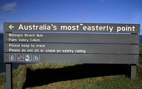
- Eastern-most point is Cape Byron in New South Wales.
- Western-most point is Steep Point in Western Australia.

Cape Byron, the most easterly point on the mainland.
Distance extremities
If you travelled across mainland Australia in a straight line (not diagonal):
- The northern most point to the southern most point is approximately 3680km (2286 miles);
- The eastern most point to the western most point is approximately 4000km (2485 miles).
Altitude extremities
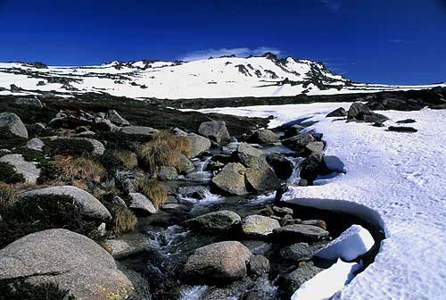
- Highest point on the mainland is Mount Kosciuszko at 2,228 metres (7309 feet).
- Highest point in the realm of Australia is Mawson Peak on Heard Island at 2,744 metres (9002 feet).
- Lowest point on the mainland and the realm of Australia is Lake Eyre at −15 metres (-49 feet).

Mount Kosciuszko is the highest peak on mainland.
Time Zones
There are three time zones in Australia. They are:
- Australian Eastern Standard Time (AEST);
- Australian Central Standard Time (ACST);
- Australian Western Standard Time (AWST).
During summer there can be up to 5 different times within the 3 time zones due to some states observing daylight saving or because daylight saving starts at different times for different states. If you consider the realm of Australia, then there are actually six time zones. The extra zones being:
- Christmas Island Time (CXT);
- Lord Howe Standard Time (LHST);
- Norfolk Time (NFT).
Map instructions and tips
- In fullscreen mode, try dragging the orange person icon located at the bottom right onto a highlighted area to see a panorama image.
- To zoom in,double click on the map, use the scroll wheel on your mouse, or try the inbuilt slider.
- To move the map, click down or touch the map, then drag with your mouse or finger.
- Search and zoom in to a specific location using the search box at the top of the map.
- Right click on the map to instantly get latitude and longitude coordinates.
- Click a city linked to the left, for a Google Map & Street View.
- Try 'Satellite' mode for real aerial images.
- View more maps of Australia.
- View photos of Australia
Author & photographer: David Johnson (Virtual Australia). Providing a credit or link is appreciated.
Our content: logos, site names, text, photos, and website design are protected by international copyright law.
Original versions of our photos can be purchased / licensed & web versions can be shared subject to conditions.
