Wainuiomata River - photos
 |
 |  |  |
 |
 |
 |
 |
 |  |  |  |
 |  |  |
 |
Related Photo Galleries | |||
 |  |  |  |
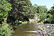
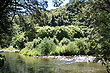
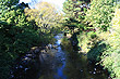
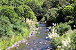
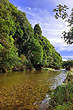
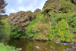
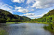
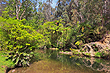
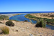
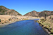
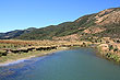
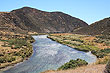
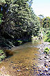
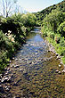
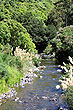
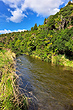
About Wainuiomata River
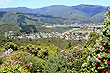
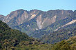
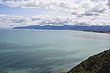
The Wainuiomata River in the North Island flows from the Rimutaka Mountains to the south coast of the North Island. 'Wai' in Māori means water, 'Nui' means big, and 'Mata' could be the name of a person.
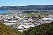
In 1884 a dam was built with water piped out of Wainuiomata through a tunnel to Seaview then onto Wellington. The dam was replaced in 1910, then in 1926, a second less known tunnel called the Orongorongo tunnel also piped water out of Wainuiomata.
Today this area still provides water to Wellington city and for this reason it is restricted to the public. Just outside the catchment area are a number of natural swimming areas and public walks that follow the Wainuiomata River and also penetrate into the forested Rimutaka hills.
Author & photographer: David Johnson (Virtual New Zealand). Providing a credit or link is appreciated.
Our content: logos, site names, text, photos, and website design are protected by international copyright law.
Original versions of our photos can be purchased / licensed & web versions can be shared subject to conditions.