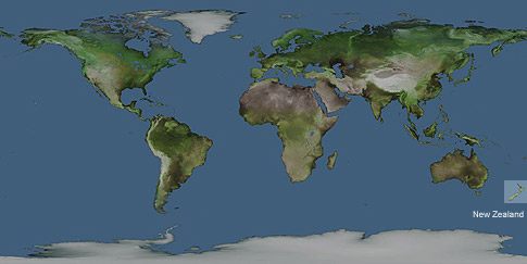
New Zealand on the World Map
Click on the New Zealand map to see a topographical view.
New Zealand is considered to be the most isolated country in the world in a geographical sense. New Zealand is on the opposite side of Greenwich Mean Time (GMt) which makes New Zealand the first country in the world to see each new day. This means the country is 12 hours ahead of England, and 24 hours ahead of some of the nearby Pacific Islands due to the International Date being nearby. If you were able to travel from New Zealand through the centre of the earth, and continued to the otherside, you would find yourself in and area between North Africa and Southern England depending where in New Zealand you were.
Author & photographer: David Johnson (Virtual New Zealand). Providing a credit or link is appreciated.
Our content: logos, site names, text, photos, and website design are protected by international copyright law.
Original versions of our photos can be purchased / licensed & web versions can be shared subject to conditions.