Oceania Political Map
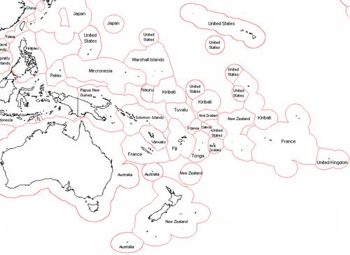
A Political map of Oceania showing who administers or owns what islands in Oceania. Australia, New Zealand, France and the United States administer or own most of the islands in this continental region.
Author & photographer: David Johnson (Virtual Oceania). Providing a credit or link is appreciated.
Our content: logos, site names, text, photos, and website design are protected by international copyright law.
Original versions of our photos can be purchased / licensed & web versions can be shared subject to conditions.