New Zealand Volcanic - photos
About
New Zealand lies on the rim of the Pacific tectonic plate which is the same fracture in the Earth's crust that passes through Japan and the west coast of the United States. This fracture passes through both the North and South islands which has created significant mountain ranges in both islands. However, the geological process for each island are different. In the South Island, the Pacific and Indo-Australian plates are grinding past each other. The resulting collisions over eons created the Southern Alps. In the North Island, one techtonic plate is sliding under the other in a process called induction. The result is smaller mountain ranges and volcanic activity.
Read more →
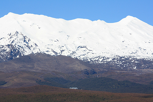
Mount Ruapehu
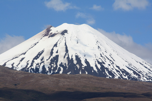
Mount Ngauruhoe
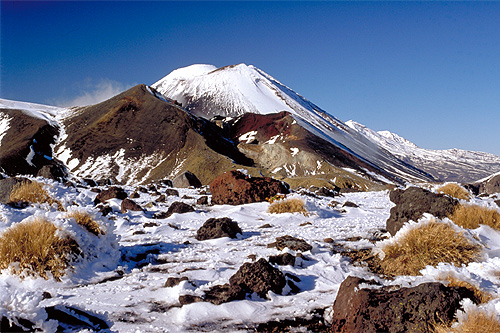
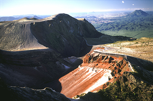
Mount Tongariro
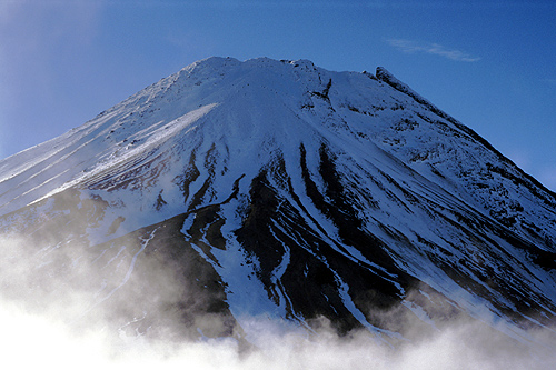
Mount Taranaki
Mount Tarawera
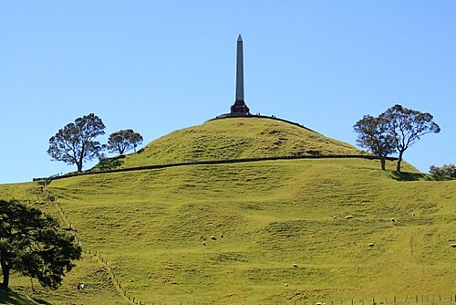
Auckland Volcanic Field
Te Puia
Waimangu Volcanic Rift Valley
Wai-O-Tapu Thermal Wonderland
Craters of the Moon
Orakei Korako
Lake Taupo
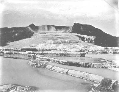
Pink and White Terraces
The volcanic attractions of New Zealand are world renown and easily rival other volcanic sites in the world like Yellowstone and Iceland. The vast majority of thermal activity is in the North Island and centred in and around the Rotorua and Taupo volcanic zones, with both being situated in the centre of the island. Mt Tongariro, Mt Ngauruhoe, and Mt Ruapehu are the main volcanoes in this area with all three considered active. Mt Ruapehu last erupted in 1995 and 1996, while Mt Tongariro erupted twice in 2013. Ngauruhoe's last eruption was further back in 1972.
To the west of the central plateau and close to the western coasline lies the lonely conical peak of Mt Taranaki. This Mt Fuji like volcano last erupted in the year 1755.
Further to the north in the Rotorua area lies Mt Tarawera. In 1886 this volcano blasted 2 cubic kilometers of lava and rock onto the surrounding countryside, killing 186 people as well as destroying New Zealand's most spectacular volcanic feature, the world famous Pink and White Terraces. Lake Rotomahana now occupies the site with Tarawera rising above the lake. The Pink and White Terraces were rediscovered at a depth of 60 metres (200 ft) below the lake floor in what is thought to be their original location.
North of Mt Tarawera and just off the Bay of Plenty coast is White Island. This volcano continually releases pressure in the form of steam and clouds, hence the name White Island. In 2019 an eruption killed 22 people and injured 34 others.
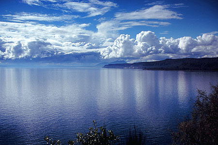
The biggest volcano in New Zealand is also the world's most destructive volcano in the last 70,000 years. It is a large caldera filled with water. Named Lake Taupo, it is the largest lake in the country and classified as one of Earth's super-volcanoes. Situated in the centre of the North Island, this volcano erupts approximately every 2000 years and last erupted in the year 186 AD. This eruption was huge. For a comparison, it was estimated to be over 50 times the magnitude of the Mt St Helen's eruption. While Mt St Helens moved 3 cubic kilometers of earth, and Krakatoa (the biggest in recent times) in Indonesia moved 8 cubic kilometers, Taupo moved 110 cubic kilometers. This eruption is regarded as the biggest in the world in the last 5000 years. The skies and sunsets formed from this eruption lasted about six months and were noted by Roman and Chinese historians. Further back, about 26,500 years, Lake Taupo had an eruption of supervolcanic proportions when the biggest and most destructive eruption in the world took place in the last 70,000 years. That event dwarfed the 186 AD eruption and ejected a massive 1170 cubic kilometers of earth giving it a Volcanic Explosivity Index rating of 8. A magnitude 8 is classified as a true super-eruption.
Outside the centre of the North Island there are other volcanoes, but they are much smaller. Both the Coromandel Peninsula and the Auckland region including Auckland city have many monogenetic volcanoes. Fortunately it has been 600 years since the last eruption. These volcanoes each erupted for a period of weeks and up to a year. These type of volcanoes are known to erupt only once. The exception is Rangitoto Island, a volcanic island clearly visible from Auckland city, the largest city in New Zealand. This island volcano rises 260 metres (850 ft) above the Hauraki Gulf the body of water on Auckland's eastern coast. Eruptions of Rangitoto are significant events and it last erupted during Maori occupation of New Zealand according to their oral traditions and legends.
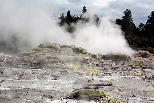
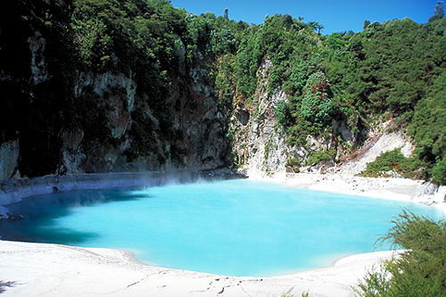
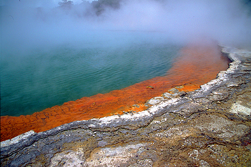
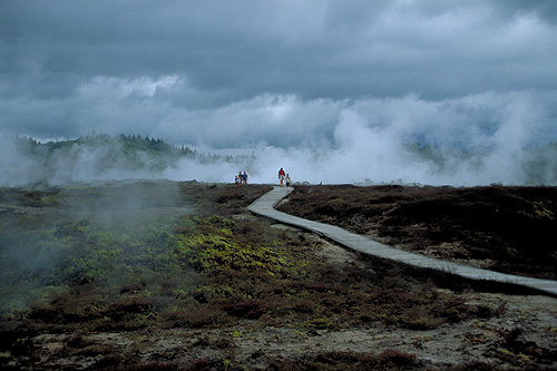
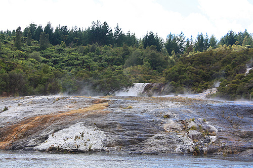
The nearby city of Rotorua contains many thermal reserves and features including boiling mud pools, hot springs, geysers, thermal rivers, boiling lakes, steam vents (fumeroles), and volcanic terraces. Rotorua attracts tourists the world over because of these attractions. It is also New Zealand's most popular tourist attraction for a good reason, but being only a few hours drive from Auckland also helps bring in the tourists. Rotorua is one of the world's great volcanic attractions with every volcanic feature that earth can offer.
Author & photographer: David Johnson (Virtual New Zealand). Providing a credit or link is appreciated.
Our content: logos, site names, text, photos, and website design are protected by international copyright law.
Original versions of our photos can be purchased / licensed & web versions can be shared subject to conditions.