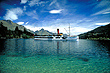
Lake Wakatipu - photos
 |  |  |  |
 |  |  |  |
 |  |  |  |
 |  |  |  |
 |  |  |  |
Related Photo Galleries | |||
 |  |  |  |
About Lake Wakatipu
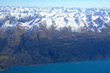
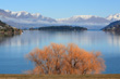
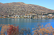
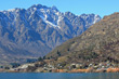
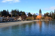
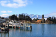
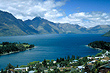
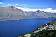
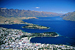
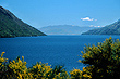
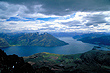
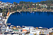
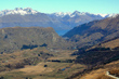
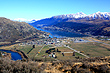
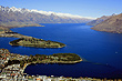
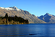
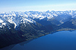
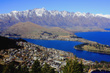
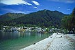
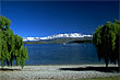
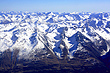
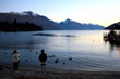
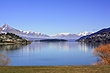
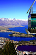
 Lake Wakatipu is 80 kilometres long making it the longest lake in the country. Its area is 291 km² making it the third largest. At 310 metres above sea level, it is surrounded on all sides by mountains with the tourist town of Queenstown nestled around Frankton Arm.
Renown for its scenic beauty and its popular tourist town, it is one of the scenic highlights of New Zealand. The Skyline Gondola in Queenstown takes tourists up a nearby hill for a spectacular view of Queenstown, Lake Wakatipu, and the aptly named Remarkables Range which is part of the Southern Alps. This mountain chain stretches the length of the South Island.
More Photos | |||
|  |  |  |
Author & photographer: David Johnson (Virtual New Zealand). Providing a credit or link is appreciated.
Our content: logos, site names, text, photos, and website design are protected by international copyright law.
Original versions of our photos can be purchased / licensed & web versions can be shared subject to conditions.