Wellington Region
Google Map
View Larger Map
Top Places
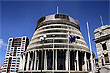
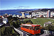
Wellington city - includes, Parliament, Te Papa, Cable Car, Civic Square, Oriental Bay, & the Botanic Gardens, Mt Victoria, Zealandia, Seatoun, Wellington harbour, and the Southern coastline. Western coastline, Rimutaka Range, Tararua Range, Kapiti, Lower Hutt, Porirua, Upper Hutt, and Eastbourne.
About
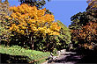
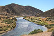
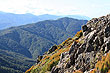
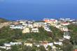
The Wellington region is located on the south western tip of the North Island. The region offers both urban and rural living with a variety of landscapes ranging from coastline to mountains.
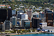
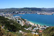
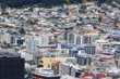
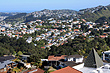
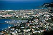
Wellington is also the name of the biggest city in the region. Wellington city is also the capital of New Zealand and the most southerly capital city in the world. The city is built around one of the world's great harbours with the suburbs flowing up and over the surrounding hills, around the intricate coastline, and inland through the Hutt Valley.
Wellington lies on the south coast of the North Island, known as the Cook Strait. This body of water between both islands acts as a funnel to the predominate north-westerly wind. In addition, the city is also exposed to the south which takes the full brunt of a southerly wind from the Antarctic which is the nearest landmass directly south. For these reasons, Wellington is known as the "The Windy City", and even though the wind can get very strong, summer and autumn are usually calm with little wind.
You often hear the locals say, "You can't beat Wellington on a good day". This is a said in defence of Wellington's reputation for unpredictable weather, but it is also true that Wellington shines brighter than any other city on a fine day due to to the crisp clean non-polluted air. Surprisingly, Wellington has a higher amount of sunshine hours than both Auckland and Christchurch.
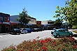
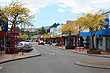
Wellington is renown for its lively social scene and bustling streets that provide great shopping, restaurants, theatre and nightlife. Wellington cafes have a national reputation for the best coffee in the country. The city is also known as the art capital of New Zealand and and there is a plethora of festivals held each year, including the Wine and Food Festival, Dragon Boating Festival, and the International Festival of the Arts. The city is also the New Zealand port for the Global Challenge which is billed as the most difficult of all global yacht races.
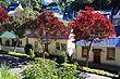
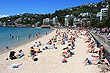
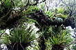
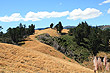
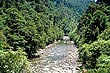
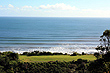
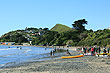
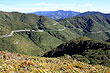
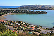
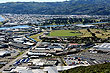
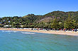
Outside of the city are other densly populated centres, (by New Zealand standards), including the Hutt Valley, Porirua, and Paraparaumu. Beyond that are mainly satellite towns and rural communities involved in farming and agriculture. The Tararua Mountains to the north are a great place to see the New Zealand bush. Mountain and coastal areas exist side by side, so there is a wide range of activites that one can indulge in. If you enjoy sswimming at the beach, then you could go to Paekakariki and Paraparaumu which also offer views of nearby Kapiti Island. City beaches include Oriental Bay, Days Bay, and Scorching Bay, which are all good swimming beaches located in the Wellington harbour.
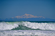
Many views of the South Island can be had from the Wellington south coast. Wellington is linked to the nearby South Island by a ferry service. Ferries depart at the northern end of Wellington City or Queens Wharf. It takes about three hours or less to reach the South Island and vice versa.
For more variety, you could also drive over the Rimutaka Hill Road to the Wairarapa Region, which is home to many vineyards and enjoys a warm and drier climate.
Photo Galleries
 |  |  |  |
 |  |  | |
 |  |  |  |
 |  |  |  |
 |  |  |  |
 |  |  |  |
 |  |  |  |
Promotional Video
Travel Links
Author & photographer: David Johnson (Virtual New Zealand). Providing a credit or link is appreciated.
Our content: logos, site names, text, photos, and website design are protected by international copyright law.
Original versions of our photos can be purchased / licensed & web versions can be shared subject to conditions.