Oceania View of New Caledonia
Click on New Caledonia in the map to view a new map.
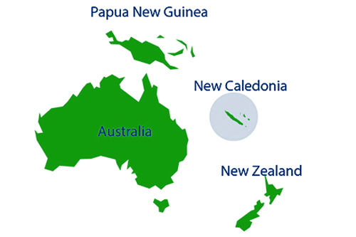
Map showing New Caledonia's location in Oceania. The nation lies east of Australia, north of New Zealand, and south-east of Papua New Guinea. New Caledonia sits in the Coral Sea, the same sea that Australia's Great Barrier Reef is located. New Caledonia is the fourth largest largest country in Oceania.
Author & photographer: David Johnson (Virtual New Caledonia). Providing a credit or link is appreciated.
Our content: logos, site names, text, photos, and website design are protected by international copyright law.
Original versions of our photos can be purchased / licensed & web versions can be shared subject to conditions.