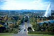
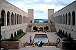
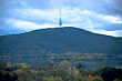
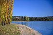
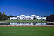
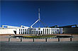
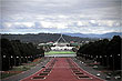
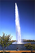
Photos

  •  Cities
•  Towns
•  Coastline
•  Barrier Reef
•  Landscape
•  Waterfalls
•  Outback
•  Fauna
•  Marsupials
•  Reptiles
•  Birds
•  Butterflies
•  Flora
•  Rural
•  Culture
•  People
•  License*


Search: 

Find a hotel


Visit the Virtual Australia Photo Library
  
Butterfly photoWe have photos from all over Australia that are available for use in photographic printing and digital media. To date, our photos have been used by companies, organisations and individuals from all over the world, for use in calendars, brochures, magazines, books, posters, business cards, websites, CDs, and Power Point presentations.

  
Click on the images to enlargen & explore. You can also license the originals.
Canberra photo
Canberra War Memorial photo
Telstra Tower photo
Lake Burley Griffith photo
Lake Burley Griffith  photo
Canberra Mall photo
Canberra Old Parliament photo
Canberra Parliament photo
Anazac Parade photo
Captain Cook Fountain photo
 

Click for Canberra, Capital Territory Forecast Canberra was pre-planned and then built in the 20th century as the new home to Australia's capital city in response to the rivalry between Melbourne and Sydney, which both competed for this title. The city is located at the northern end of the Australian Capital Territory, 280 km (170 mi) south-west of Sydney, and 660 km (410 mi) north-east of Melbourne. Canberra is Australia

Canberra employs more gardeners and landscape artists of any city in the world per head of population. The city has native trees lining the streets and there many well kept parks. Lake Burley Griffin is a prominent lake surrounded by park land.

Canberra location mapCanberra's status as the capital of Australia means that most embassies and consulates are located here and they seem to compete for design finess. The city is also the site of Parliament House, the High Court of Australia, and numerous government departments and agencies. Canberra is also the location of many social and cultural institutions of national significance, such as the Australian War Memorial, National Gallery of Australia, National Museum of Australia, and the National Library of Australia. The federal government contributes the largest percentage of Gross State Product and is the largest single employer in Canberra.

Canberra covers an area of 805.6 square kilometres (311.0 sq. mi) and is located near the Brindabella Ranges, approximately 150 kilometres (93 mi) inland from Australia's east coast. It is located at altitudes that range from 550 metres to 700 metres (1,800 to 2,300 ft). The highest point is Mount Majura at 888 metres (2,913 ft). Other large hills include Mt Taylor, Mt Ainslie, Mt Mugga Mugga, and Black Mountain. The surrounding bushland and the original bushland that Canberra was built in is a mixture of eucalyptus savanna, scrubland, swamp, and dry eucalyptus forests.


This web site, logo, name, content, photos, and design are protected by international copyright law.
Original versions of our photos can be purchased & web versions can be shared subject to conditions.