How big is Australia?
Maps comparing the size of Australia to other countries and regions in the world.
Australia compared to Europe
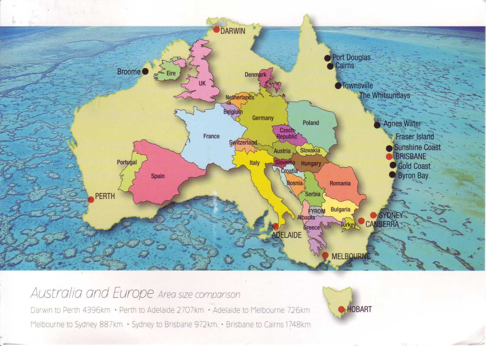
Map showing Australia over Europe. Broome to Sydney covers the same distance as England to Turkey. Perth to Sydney is like travelling from Spain to Syria.
Australia compared to the USA
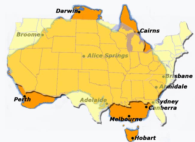
The map above shows Australia overlayed with the USA (without Alaska). Both countries main landmass are comparible in size. While Alaska is not shown, Australia does have a large region in the Antarctica called 'Australian Antarctic Territory' which covers nearly half of the Antarctic continent. However, USA doesn't recognise this territory but other countries such as Britain and France do.
Australia compared to a range of countries
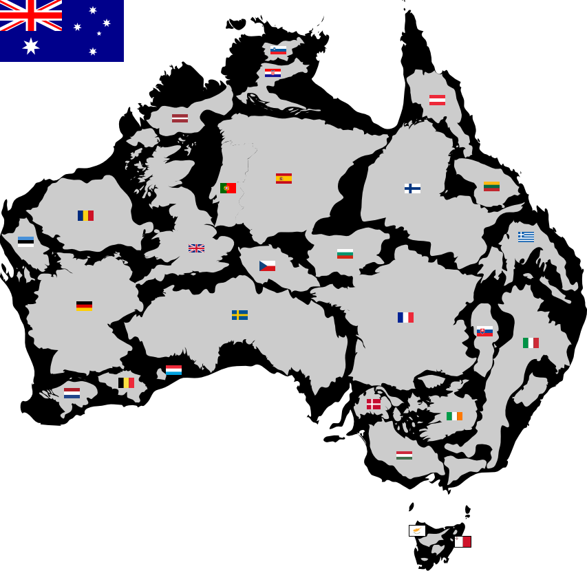
Map above showing countries to scale that can fit inside Australia.
The Great Barrier Reef overlayed in Europe
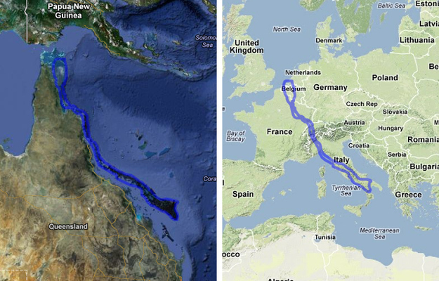
The Great Barrier Reef is the largest reef system on Earth, It is made up of about 3000 individual reefs. Clearly visible from space, it has the equivalent length of the eastern coastline of the USA. It also measures about the same length as The Netherlands to southern Italy or England's south coast to the top of northern Africa.
Perth to Australia and London to Moscow comparison
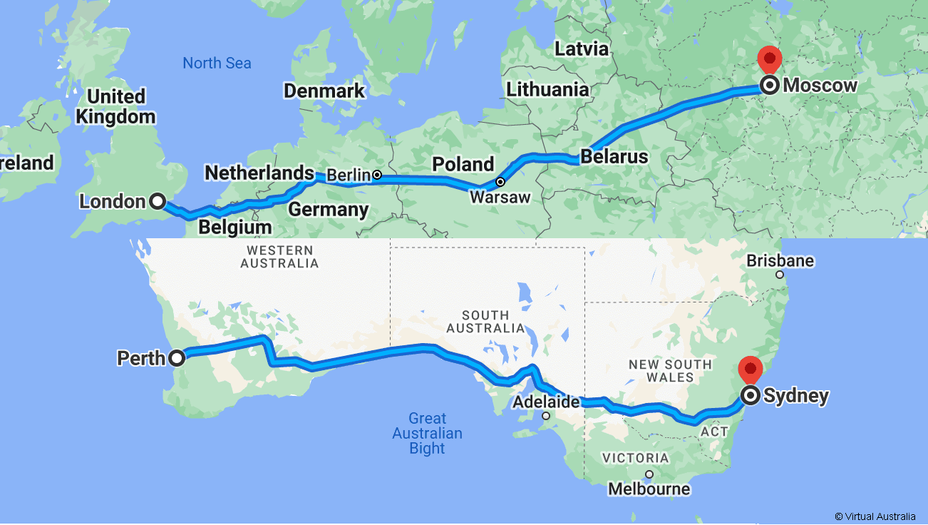
The straight line distance between London and Moscow is 2501 km / 1554 mi.
The straight line distance between Perth and Sydney is 3297 km / 2049 mi.
Driving from London to Moscow takes 31 hours on the M1. That is a distance of 2876 kilometers or 1787 miles.
Driving from Perth to Sydney takes 41 hours on the A1. That is a distance of 3930 kilometers or 2442 miles.
Author & photographer: David Johnson (Virtual Australia). Providing a credit or link is appreciated.
Our content: logos, site names, text, photos, and website design are protected by international copyright law.
Original versions of our photos can be purchased / licensed & web versions can be shared subject to conditions.